Fire Trails in Austinville
Wildfires represent one of the biggest risks to Austinville Valley. In 2019, uncontrolled wildfires burnt a significant portion of Eastern Australia causing catastrophic loss of human life, homes, infrastructure and wildlife.
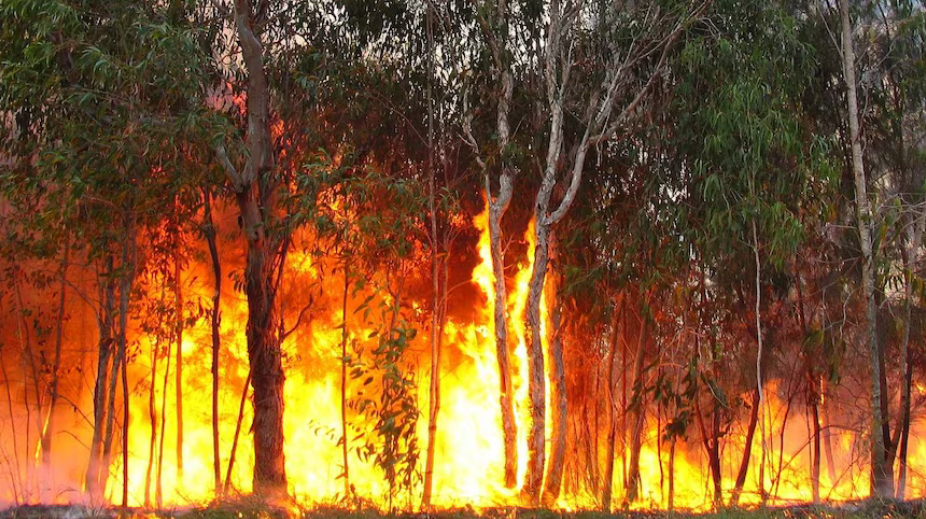
It is critically important to take personal responsibility and make your own home safe and to develop a fire plan. This will go a long way to saving your house and your family, however there is also a need to manage fire at a landscape scale. Fires can move rapidly across the landscape. A fire in Springbrook, Tallebudgera or Bonogin could quite rapidly cross large areas of land and threaten Austinville. The best way to manage the risk of large wildfires is to have well managed, accessible fire trails.
Fire trails can be used in cooler times of the year as a starting line to carry out ecological and fuel load control burns. When carried out by experienced fire managers these fires can benefit the forest and its wildlife and reduce the fuel load which in turn reduces the intensity of possible future wildfires and thereby protects homes and other infrastructure.
Fire trails can also be used as a starting line to carry out back burns in the face of oncoming wildfires. These back burns are usually burnt down-hill so they are less intense, but they still greatly reduce the intensity of an oncoming wildfire. Fire Trails can also be used for access in times of flood, and for feral animal and invasive weed management.
To carry out fuel reduction and back burns it is essential that fire trails are accessible and driveable by Rural Fire Brigade trucks. This was not the case in 2022. Many of the fire trails in the valley were unusable.
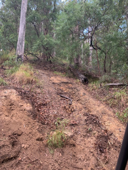
FOAV’s sister organisation, Austinville Landcare, recognised this need and successfully won a $300,000 grant to create and upgrade twenty kilometers of fire trails in Austinville, ensuring they are accessible to Rural Fire Brigade trucks. The photo below illustrates the contrast in driveability of the fire trails after the Austinville Landcare grants.
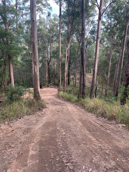
Since then, FOAV and Austinville Landcare have worked closely with Council to encourage the completion of a network of tracks throughout the valley. Council has been extremely responsive, and the combined efforts of Austinville Landcare and Council has resulted in a network of tracks that encompass and cross the entire valley – significantly improving our community’s protection from wildfires.
The map below illustrates the location of these fire trails.
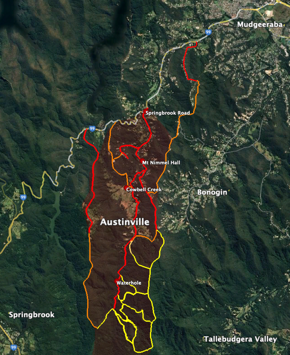
Yellow trails – made and upgraded by Austinville Landcare
Orange trails – made and upgraded by City of Gold Coast
Red lines – Existing roads